Showing posts with label National Parks. Show all posts

Monday, June 11, 2018

Hiking The Beehive in Acadia National Park

Called by some as the "crown jewel of the North Atlantic Coast," Acadia National Park in Maine is the only national park that can be found in New England. It's a relatively small park by national park standardscoming in at "only" 49,000 acres—but it protects much of Mount Desert Island, the 6th largest island in the lower 48 states. Back in May, a few of the educators from The Ecology School—myself includeddrove the 3.5 hours from Saco, Maine, to Acadia National Park for a weekend filled with hiking and exploring. While there, one of the other educators and I decided to climb the  famous Beehive.

The Beehive Acadia National Park
The Beehive is a granite knob that rises 520 feet above the Atlantic Ocean on the southeastern corner of Mount Desert Island. You can access the summit via The Beehive Trail, whose trailhead is found just near the Sand Beach parking lot. This trail is challenging and offers beautiful views, but it also comes with a much higher risk factor than your average trail. To give you an idea of just what you're climbing up when you hike this trail, take a look at the photo above. The knob pictured is The Beehive. If you look at the zoomed in portion (remember you can always click on a photo to enlarge it), you'll notice a red circle. In that circle is a person, and that person is on The Beehive Trail.

Original figure made by Martin D. Adamiker [CC BY-SA 3.0 (link) or GFDL (link)], via Wikimedia Commons. Figure modified (addition of arrows and text) by Kyle Brooks.
Before we get to what the actual hike is like, I want to spend some time talking about the geology of Mount Desert Island, and especially The Beehive itself. As with many places in the northern portions of the United States, Mount Desert Island was heavily shaped and modified by various glacial periods during the last Ice Age. The last glacial periodthe Wisconsin Glacial Episode—began around 70,000 years ago and finished up around 12,000 years ago. At its greatest extent, this giant sheet of ice completely covered Maine, including Mount Desert Island. In this part of the world, the glacier moved from the northwest toward the southeast. As it moved over Mount Desert Island, it eroded the mountains that were present on the island into long, yet narrow, formations that were separated by U-shaped valleys. 

The Beehive Geology Plucking and Abrasion
Left: A smooth granite face resulting from glacial abrasion.
Right: A jagged, steep granite face resulting from glacial plucking.
As the glacier eroded the mountains on the island, it did so in two different ways, all dependent on which direction the side of the mountain was facing. Take, for example, The Beehive. Parts of The Beehive experienced glacial abrasion, while other parts experienced glacial plucking. Glacial abrasion and plucking are both examples of how a glacier can erode bedrock, but these two types of erosion are a result of different factors and forces. Subsequently, they end up leaving behind different geological features after the glacier retreats. The northwest side of The Beehive was eroded by glacial abrasion. In this case, the glacier smashed directly into the northwest side of the knob. This force of pressure, coupled with the rocks embedded in the bottom of the glacier, smoothed and polished the bedrock like sandpaper on a piece of rough wood. This left behind a large face of smooth, rounded granite.

The southeastern side of The Beehive, however, experienced erosion via glacial plucking. As the glacier polished the northwest side of the knob, it moved over the knob and slid down the southeastern side. As the ice slid down this side, frictional forces caused some of the ice at the very bottom to melt. This liquid water then entered into cracks and joints that were already present in the bedrock, were the water consequently refroze. Since water expands when it freezes, this resulted in large boulders cracking and breaking free of the knob. These boulders were then "plucked" up by the bottom of the glacier, where they were transported and dropped into the ocean or elsewhere. The resulting rock face was not highly smooth and polished, but was instead a steep cliff side with a jagged face. It's on this plucked side of The Beehive that the trail ascends.

Photos of The Beehive Trail Maine
The trail up to the summit starts out easy enough. The trailhead is at the bottom of a gully lined with granite boulders of various sizes—many of which were dropped there after being plucked off the knob by the glacier. This part is straightforward; one just has to watch their footing as they walk from rock to rock and keep an eye out for the blue blazes marking the trail.

The Beehive Trail Mount Desert Island Maine
The boulder field eventually ends at the base of the plucked side of the knob. This is where the scrambling begins. Scrambling is the type of hiking that is in between walking and technical rock climbing. Basically, it's walking up or down a rocky area that requires you to use your hands relatively often, but it still doesn't require technical gear like rope and carabiners.

Metal Rungs The Beehive Trail
This is also the first part of the trail in which you encounter the metal rungs, which you will soon come to rely on. As with many of the steep, rocky trails in the national park system, metal rungs were added at some point along the trail for hikers to more safely navigate. In the case above, metal rungs were added so hikers could safely cross a gap in the rock face.

Sand Beach Acadia National Park
Rather quickly, you are rewarded with grand views of the southeastern side of Acadia National Park. Features like the Sand Beach come into view. Although sandy beaches are not rare in the world by any means, the Sand Beach in Acadia National Park is significant. Maine is not known for sandy beaches; in fact, of the 3,478 miles of shoreline found in Maine, there's only about 40 miles of sand-based shorelines (~1.15% of the total). The Sand Beach in Acadia National Park represents about 290 yards of that 40 or so miles, and the only sand-based beach you'll find on Mount Desert Island.

Climbing The Beehive Trail
While the trail gets higher and higher, and the views get better and better, the trail also becomes increasingly more climbing-based. The trail also becomes smaller, and gaps become more prevalent. At one point a short wooden bridge is required to cross a gap.

Views from The Beehive Trail
Your blogger embracing his inner mountain goat.
Some sections of the trail are very narrow, like the one pictured above. Sure-footing, grippy shoes, and patience are a must.

The Beehive Trail Maine
About halfway up the trail, you reach an "Oh boy" section—at least it was for me. There is a relatively long, and steep, section of the trail that requires lots of climbing up metal rung after metal rung. And to make things more interesting, decades of use by hikers have worn smooth the parts of the granite along the trail, making them slippery. This last half of the trail is extremely reminiscent of the Angels Landing Trail in Utah's Zion National Park. I hiked up Angels Landing in the summer of 2016, and that trail is another example of scrambling up a steep rock face with the use of metal rungs and chains. (Check out my "Hiking Angels Landing" post to see just what I'm talking about.)

Hiking The Beehive Acadia National Park
Leah ascends part of the more steep sections of The Beehive Trail.
Is the trail dangerous and hard to do? Yes and no. All hiking comes with risks. Although The Beehive Trail does have more risks involved than your average stroll through a city metro park, deaths and serious injuries are rare (but they do happen.) The trail itself isn't that strenuous for an average hiker that is at least somewhat in shape and has full control over their extremities. Hiking up the trail and returning via the Bowl Trail (it is not recommended that you descend the way you came up) is only 2 miles, and there's only about a 450 foot elevation gain in total. That's not much at all in the hiking world. The biggest challenge hikers face is the fear factor. Afraid of heights? Well, this trail might not be for you. I've heard stories about hikers getting halfway up the trail, only to become frozen in fear. The only way out is up, though.

The Beehive Summit Marker
If you don't mind heights and cliff sides, and you're willing to do a bit of non-technical climbing and scrambling, then you'll love this trail. It's absolutely beautiful, and it's been one of my favorite hikes that I've done east of the Mississippi River.

Kyle Brooks Nature Writer
Even though the summit is only at 520 feet above sea level, The Beehive sits on the edge of the Atlantic Ocean, so the views are fantastic. You can see miles and miles of the ocean, Mount Desert Island, and the mainland. If you ever find yourself in Downeast Maine, head over to Acadia National Park and hike The Beehive; you won't regret it!

Tuesday, October 4, 2016

Hiking The Narrows

A couple weeks ago I covered one of Zion National Park's most well-known hiking experiences, Angels Landing. This week I want to cover probably the most well-known hiking experience at Zion Nation Park, The Narrows.

View from Angels Landing
Zion National Park lies in the Southwest corner of Utah. Although the park is huge and has many different areas, the main and most-visited area is the famous Zion Canyon. This canyon can be broken up into two main parts: the upper canyon (The Narrows) and the Lower Canyon. The photo above shows the beginning of the Lower Canyon portion as looking up-canyon from atop Angels Landing. Where the canyon pinches off in the middle of the photo is where The Narrows, a slot canyon, begins.

Why is there a rather-abrupt change from the slot canyon that is The Narrows to the quarter-to-half mile wide Lower Canyon? It all has to do with the rock layers. During the Mesozoic Era, the area that now encompasses Zion NP used to be a flat coastal plain. Most of the rocks in Zion were laid down during the Jurassic Period. Beginning in the Cretaceous Period, this entire region of the West experienced a period of uplifting, where the layers of rocks were slowly thrust upward to heights from near sea level to over 10,000 feet above sea level. The ancestral Virgin River, through the power of erosion, began to cut downward through these rock layers as the layers were uplifted. When the Virgin River arrived at what was to become Zion NP, it hit the massive layer of Navajo Sandstone (which is upwards of 2,200 feet thick). Sandstone is a rather hard rock which isn't easily eroded. Generally speaking, soft rocks form broad canyons and slopes when eroded, while harder rocks tend to form cliffs and slot canyons (A slot canyon is essentially a really narrow canyon that is deeper than wide). The Virgin River, trying to follow the path of least-resistance to the sea, cut straight down through the Navajo Sandstone Formation. This resulting deep, but narrow, canyon became known as The Narrows.

Riverside Walk Trail Zion National Park
Heading toward The Narrows.


After the Virgin River cut through the entirety of the Navajo Sandstone Formation, it ran into the Kayenta Formation. The Kayenta Formation is a rather soft formation, and the Virgin River was able to erode a much wider canyon. The transition between The Narrows and the relatively wide Lower Canyon occurs at the transition between the hard Navajo Sandstone and the soft Kayenta Formation below it.

Riverside Walk Trail (Left), Southern Maidenhair Fern, Adiantum capillus-veneris (Right)
With this post, I want to take you on a pictorial journey through the day-hike section of The Narrows. I hiked 4 miles up The Narrows during a warm day in late July, and I have to say it was one of most fantastic and unique hiking experiences I've yet to have. There are two ways to hike The Narrows. The easiest way is bottom-up. For those wanting a more hardcore experience, you can do the top-down route. This is a 16 mile one-way backcountry experience which requires a permit and a lot of hiking experience. The most common way to experience The Narrows is the bottom-up route, which is the route I chose. It is non-technical, requires no permit, and can last as long as you want. The bottom-up route begins at the Riverside Walk trailhead, a mile-long paved trail beside the Virgin River. Although you're in the desert, the cool, moist microhabitats created by the tall cliffs and seeping springs result in an explosion of green. One point of the trail passes a marsh, while parts of the cliff walls near seeping springs are covered in plants like the Southern Maidenhair Fern (pictured above on the right).

Mystery Falls
After a mile, the paved trail ends, and The Narrows begin. There is no "trail" through The Narrows. The vast majority of your time will be spent wading through the Virgin River itself. It's a very different kind of hiking experience. You have to watch each step, as not only are you competing against the current, but the riverbed is made of large, slippery rocks. I watched dozens of people slip and fall into the water. Although I did it without trekking poles, I wish I had brought them. One of the first stand-out features in the canyon is Mystery Falls, which is the steep orange slope in the center-right of the photo above. There are several opportunities for technical (requiring specific rock-climbing equipment and knowledge) canyoneering within the park, and Mystery Canyon is one such opportunity. Mystery Canyon requires 12 rappels, and the final rappel is down the 120-foot Mystery Falls. On my return hike, I stopped to watch a few hikers rappelling down the slippery algae-covered waterfall. Seeing hikers rappel down a waterfall is a rather interesting activity to watch. If you want more info on this technical hike, visit this Canyoneering USA page.

Zion National Park Trails
The Narrows is probably the most-popular hike in Zion. When I did it, I passed hundreds and hundreds and hundreds of people. People are drawn to this hike not only because of the beauty and ease of access, but also because of the opportunity to escape the harsh heat of the park. Although it was 90 some degrees out in most of the park when I went, the canyon itself was about 70 degrees. The Virgin River was very cool too, but not uncomfortable. Because of these features, tourists flock to the trail. The first mile or two can seem like an amusement park with the amount of people present, but the number of people on the trail drops off steeply after about 2 miles. I have to admit, I didn't expect it to be as busy as it was, but you quickly leave the hordes of people after about an hour of hiking.

Hiking The Narrows
The soaring walls of the canyon quickly narrow as you make your way upstream. The giant boulders and carved sandstone walls remind you of the time and power that it took the Virgin River to carve out this canyon.

Orderville Canyon Zion
About 2.5 miles from the start of The Narrows, you run into a fork in the canyon. If you hang left, you continue on with The Narrows. If you hang a right, you enter Orderville Canyon, a smaller side canyon. Orderville Canyon is narrower and darker than The Narrows proper, and it was a lovely little place to explore. Those, like me, who are doing the bottom-up trek cannot go past a certain point in Orderville Canyon. The turn around point for bottom-up hikers is just a bit around the bend in the photo above. You can, however, get a permit and do the entirety of Orderville Canyon from top-down. It does, however, involve some technical canyoneering skills (rappelling). If you want to read more about the Orderville Canyon hike, check out this Canyoneering USA link!

The Narrows Wall Street
Wall Street in The Narrows, with 1,500 foot canyon walls and the river reaching from wall-to-wall in most sections (I hiked in low water levels, so there's more exposed land than what there normally is).
It wouldn't be a post on a slot canyon without talking about the inherent dangers of hiking in one. I did this hike during the North America Monsoon season. During the late summer months, storms with torrential rain can pop up anywhere out West. Flash flooding is a serious concern, and even more so in a slot canyon. The Narrows regularly closes several times a year when there's a threat of flash flooding. Why? Because there can be literally no place to go. In some sections, there can be high ground to seek refuge on if you're caught in a flash flood. However, many sections of the canyon don't offer such protection. Take, for example, the Wall Street section of The Narrows, just upstream from Orderville Canyon. As you can see in the photo above, the Virgin River stretches wall-to-wall. There is no safe high ground. If a flash flood comes roaring in while you're here, you will die. You cannot outswim a flash flood, mainly due to the force of the current and the debris the river picks up. Imagine having trunks of trees ripped-out from the flood hurtling toward you at 30 mph; it's not going to be a pretty ending. Check out this Youtube video of a flash flood at The Narrows to see the danger of such a flood.

The National Park Service will close The Narrows to hikers if it seems a flash flood is potentially possible for that day. That doesn't mean that one can't pop up unexpectedly with no warning. Even if the sky is blue over The Narrows, a rain event out of sight at the headwaters can send a wall of water downstream. Be aware: if you hear a rumbling in the canyon, get to high ground. If the water begins to change color, get to high ground. If the water seems to be ever-so-slightly rising, get to high ground. Just be aware, and if it seems like it might be a bad day to do this hike, don't do it. Remember, in a national park your safety is your responsibility, not the National Park Service's.

The Narrows Utah
If you're ever in Zion National Park, and you can (safely) hike The Narrows, I highly, highly suggest that you take the opportunity to do so. It is not an experience you are going to ever forget. The towering walls, the interplay between the sunlight and shadows, and the refreshing water of the Virgin River all combine to create a fantastic hiking experience.

Thanks for reading!

Tuesday, September 20, 2016

Hiking Angels Landing

I woke up early, packed up my tent, and drove the short distance from my dispersed campsite to Springdale, Utah. With my daypack on my back, and my trek poles in my hands, I boarded a Zion National Park shuttle bus and rode into Zion Canyon. "Stop Number 6, The Grotto." I got off the bus, filled my water, adjusted my poles, and started off down the trail. As the tall Fremont Cottonwoods gave way, and the view opened up, my eyes gazed upon the towering sandstone cathedral, so appropriately named Angels Landing, before me. What in the world did I get myself into.

Angels Landing Zion National Park
Angels Landing is a large rock formation cut from the massive layer of Navajo Sandstone by the Virgin River. It is just one of the many features in the iconic Zion Canyon in southwestern Utah. I hiked the famous trail back in mid-July during my Arizona-to-Ohio roadtrip. This post is essentially just a pictorial journey up to the top with some fun facts and tips thrown in.

Soaring 1,488 feet above the canyon floor, Angels Landing received its appropriate name when Frederick Fisher, who was exploring the canyon with 3 others back in 1916, gazed upon the formation and claimed "Only an angel could land on it." Back then, there wasn't a trail leading to the top. Ascending Angels Landing was an incredibly difficult task and required a lot of rock climbing, and the first recorded ascent was in 1923 by park ranger Harold Russell. Although this was the first recorded ascent, it doesn't mean this was the first time someone ever got to the top. If anyone had previously, their name is lost to history.

Angels Landing Trail
We humans have an insatiable urge to get on top of tall and hard to reach places, and Angels Landing is no exception. In 1926, Walter Ruesch, the park superintendent at the time, began a project to build a trail that would reach the top, allowing the visitors to the relatively-new Zion National Park to make the trek up this formidable formation. Upon completion, the trail came in at 2.4 miles from the start point to the top of Angels Landing (4.8 miles round trip). The trail starts at the Grotto Trailhead, crosses the Virgin River, and begins a gently ascending path along the canyon floor toward the wall. Upon hitting the canyon wall, a series of winding paved switchbacks (pictured above) begin. This is where the hike really kicks in.

Refrigerator Canyon Zion
After the first set of switchbacks, the trail rewards you with a slight respite. The trail levels out as you make your way through a much smaller side canyon called Refrigerator Canyon. The name fits quite well; the temperature in the shady canyon is much, much cooler than the exposed parts of the trail. This cool canyon offers a lower-elevation foothold for the Rocky Mountain Douglas-Fir (Pseudotsuga menziesii var. glauca). Typically, Douglas-Firs begin to appear around 6,000 feet above sea level in Utah, yet this canyon is about 1,000 feet lower than that. Nevertheless, the cooler temperatures allow the persistence of this cooler-weather pine.

Walter's Wiggles


The refreshing break of Refrigerator Canyon ends all too soon. The trail quickly arrives at the bottom of the infamous Walter's Wiggles, a section of 21 tight and steep switchbacks. The photo above shows only 9 of the 21 switchbacks, just to give you an idea. Check out this link to see a photo of the entire section. Back and forth and back and forth you go, slowly gaining more and more elevation. This section of the trail is named after Walter Ruesch, who I mentioned a bit earlier. The creation of this section of trail allowed for hikers to reach Scout Lookout without having to climb the sandstone cliffside.

Angels Landing Zion National Park
As you round the 21st switchback of Walter's Wiggles, you come to a flat, sandy area called Scout Landing. This is an area where most people take a long breather and decide whether or not to make the final push up Angels Landing. The paved trail ends here, and the remaining 500 vertical feet of your 1,488 foot climb towers in the distance. For many people, Scout Landing is far enough. I passed several people who turned around at this part of the trail. I don't blame them; looking at the final half mile of the trail made me seriously consider turning back. It looked terrifying. I knew that I would never forgive myself if I didn't finish the trail after coming this far, so I took a deep breath, calmed my nerves, and started toward the trail. And I'm so glad I did, as the trail looks much more difficult and scarier than it really is. A word of caution: Many people like to leave their backpacks at Scout Landing before climbing up. DO NOT DO THIS. There are Rock Squirrels all over Scout Landing, and they know that humans keep food in their packs. These squirrels will chew holes into unattended packs, leaving a nice surprise for returning hikers. I passed one unattended pack with a squirrel-butt sticking out of a nice two-inch hole. Don't let that be your pack.

Angels Landing Trail
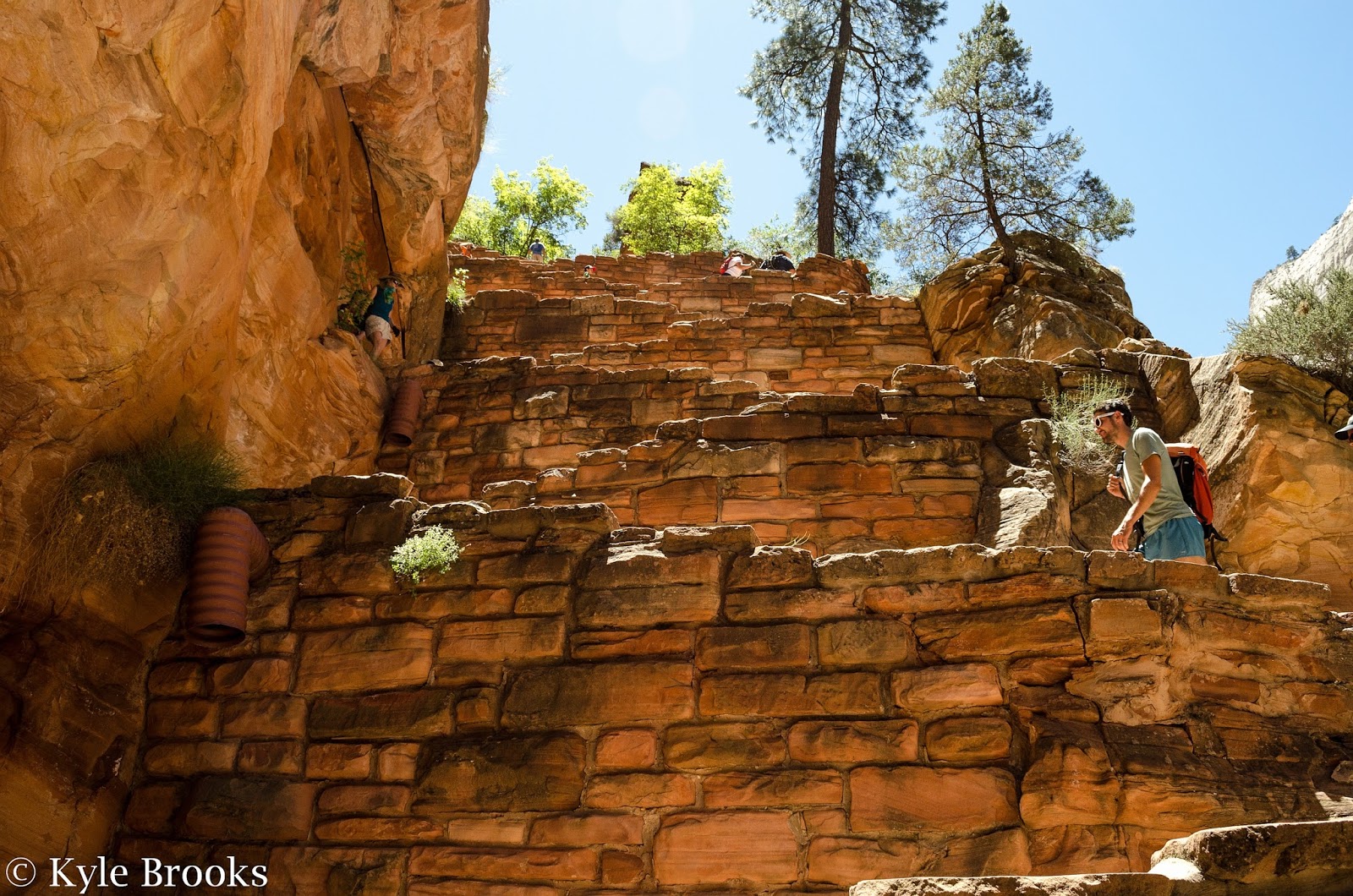
The final leg of the trail, up the actual Angels Landing formation, starts at...this. And yes, this is as steep as it looks. After arriving at this point, I couldn't help but utter "...seriously?" Thankfully, this was probably the most difficult part to navigate. This is the beginning of "the chains" portion of the trail. From here on up, chains were installed to help hikers make their way up more safely. These chains might offer more of a sense of safety than actual safety, however. A good rule of advice I read is that if you feel you couldn't make the hike without the chains, you probably shouldn't attempt this section.

Angels Landing TrailThe Angels Landing Trail is infamous in the hiking world, and the photo above shows why. That's the trail on the left. And that's a 1,000-some foot drop, right next to the trail. There's little room for error on much of this last section, as sheer cliffsides are often only a few feet away. Add dozens of people going up and down, crowding the already narrow trail, and say hello to your adrenaline rush. The section of trail pictured above is the narrowest section in the hike. But just how narrow is it?

Angels Landing Trail
It's this narrow. This is a photo of me standing right on that section pictured previously. The trail is maybe 2/2.5 feet wide at most. On either side of me is a ~1,000 foot cliff. The National Park Service stresses that you shouldn't attempt this trail if you're afraid of heights, and this is exactly why. If you aren't at least comfortable with this, this trail isn't for you. You have to pay close attention to every step you take, and that becomes hard if you're overwhelmed with fear.

Angels Landing Trail
I took the final half mile of the trail very, very slowly. The trail can be really busy at times, and you often have to stop at a safe area and wait for groups of people to pass you either going up or down. Most of the trail is only one-person wide, so there's a lot of this stopping and starting. This is definitely not a trail to do if you're in a hurry. You can see from the photo above that the last half mile isn't actually a hike, but a rock scramble. Rock scrambling is a method of navigating up or down steep rocky terrain using both your feet and hands. It's the non-technical middle ground between hiking and rock climbing.

Top of Angels Landing

After 2 grueling hours and 1,488 feet in vertical elevation gain later, I stepped onto the summit of Angels Landing. It was one of the most rewarding feelings I've ever felt. Squirrels and chipmunks scampered around the exhausted hikers and stunted trees. Two Peregrine Falcons, which nest on the cliffsides, darted through the air. A lone California Condor soared by on a rising thermal. 

Zion Canyon
The hike was all worth it. The views of Zion Canyon from 1,488 feet above the mighty Virgin River were astounding. This is the view from looking down the canyon.

Start of The Narrows Zion National Park

Angels Landing is relatively far-up the wider portion of Zion Canyon. This is the view looking up the canyon. The Narrows, another incredibly famous hike, begins where the canyon walls pinch together near the center of the photo.

Big Bend Zion National Park
Looking down toward The Organ from Angels Landing.
From atop Angels Landing, you are rewarded with a bird's-eye view of the Big Bend. Here the Virgin River lazily winds around a small rock formation named The Organ. On the other side of the river, you can see where Echo Canyon (another side canyon) joins the main Zion Canyon. The confluence of Echo and Zion Canyons is the trailhead for 3 popular hikes: Weeping Rock, Hidden Canyon, and Observation Point.

Kyle from Ohio
Of course, you have to get the obligatory photo of yourself while atop Angels Landing. This was personally the hardest hike I've ever done (so far), but I'm so glad I did it.

Here are a few personal tips for those considering hiking Angels Landing someday:
  • Take plenty of water, and DRINK it. I knew I was going to need a lot of water, and even then I still became stupidly dehydrated. By the time I got back to Scout Landing, and the adrenaline wore off, I realized I had pretty bad heat exhaustion. It got pretty serious before I got back to the shuttle bus. You need way more electrolytes and water than you think you do. 
  • I highly suggest using trekking poles for the paved portion of the trail. They really help take the strain off of your legs (especially your knees while heading back down). HOWEVER, if you do use trekking poles, make sure that you can safely store them on/in your pack while doing the chains sections of Angels Landing; you'll want both hands free for this part. Using trekking poles during the last half mile adds unnecessary risk.  
  • Use very small steps when hiking uphill to save energy. People tend to take large steps when going uphill, but this utilizes more energy as your muscles must perform more work. Big steps equal quicker exhaustion and soreness. Take it slow, and take it small.
  • There is absolutely NO shame in turning around at ANY POINT during the trail. If you feel like you can't continue, turn around. Don't risk your life. More than 5 people have died on this trail in the past few decades. This isn't a trail to mess around on. 
Thanks for reading this long post! At least there were lots of photos!

Thursday, August 25, 2016

National Park Service Centennial

I am alive! Between being incredibly busy and having a total lack of motivation to write, I haven't posted anything in nearly 2 months. But here I am, and for a special day. Today, August 25, 2016, is the 100th birthday for the National Park Service! I just wanted to throw together a few photos highlighting the national parks I've been to, along with some suggestions of things to do at those parks and what have you. So, here we go!

Grand Canyon Winter
Grand Canyon National Park, one of the quintessential national parks in the United States.


The National Park Service was established on August 25, 1916, by the National Park Service Organic Act as passed by Congress and then-president Woodrow Wilson. Actual national parks are older than 1916, however, with Yellowstone National Park (established in 1872) being the first national park in the United States. Several other national parks were then created, but each of the parks were individually managed. As the parks grew in number, Congress decided to establish an agency that would collectively oversee the parks, instead of leaving them to be individually managed.

White Sands National Monument
The National Park Service doesn't only manage and oversee national parks; the agency also manages most national monuments, such as White Sands National Monument in New Mexico, which I've covered previously. In addition to National Monuments and National Parks, the agency manages several other types of locations such as National Historic Sites, National Battlefield Parks, National Parkways, National Recreation Areas, National Seashores, and other such properties.

Petrified Forest National Park
As of now, I've personally visited 11 (of the 59) national parks and many other locations managed by the NPS. They all have their incredible beauties and differences, but I've never been to a single national park that left me underwhelmed. My personal favorite, so far at least, has been Petrified Forest National Park (which I've covered at this link) in Arizona. It was the first park I was able to visit west of the Mississippi River, and it was the first place that I really got a taste of "The American West."

Arches National Park
Another personal favorite is Arches National Park. The juxtaposition between the beautifully sculpted red sandstone with the soaring La Sal Mountains in the background just makes for a mesmerizing place.

Zion Canyon
Zion Canyon in Zion National Park, Utah, as seen from atop Angels Landing.


This summer, while coming home from a field technician job in Southeast Arizona, I decided to take a 10 day road trip back to Ohio. I meandered up through Arizona, through southern Utah, through Colorado, and then back to Ohio via I-70. My plan was to hit as many national parks and other awesome natural areas as best I could for as cheaply as I could. In total I visited 5 national parks, and an assortment of national forests and other parks.

Zion National Park Hikes
The Narrows Hike (Left), Angels Landing Hike (Right)

The two most memorable hikes from my roadtrip both came from Zion National Park in southwestern Utah. I did both the two most famous hikes at Zion: The Narrows and Angels Landing. The Narrows is a deep and narrow canyon which one can hike through. There is no "trail," and you just hike through the Virgin River. I opted to do 4 miles upstream and then 4 miles back downstream. The Angels Landing hike is a grueling climb up to the top of Angels Landing, a rock formation which rises 1,488 feet above the floor of Zion Canyon. The Angels Landing hike is infamous for the last 500 vertical feet in which you have to scramble up a steep sandstone face with over 1,000 foot drops on either side of the trail (which is sometimes only 2 or 3 feet wide). I'll hopefully be writing a post or two more on Zion in the near future!

Grosvenor Arch

Many National Parks, especially ones like Yellowstone, the Grand Canyon, and Yosemite, are known for being really busy, especially during the summer months. People visit these parks in droves because they are something special, but not every place the NPS manages is crowded and overflowing with people. In fact, if you're willing to sacrifice some comforts, you can easily escape the crowds. For example, try visiting busier parks in the winter, when attendance is drastically down. Another thing you can do is simply go off the beaten path. Take the photo above. This double arch is called Grosvenor Arch. It's in Grand Staircase-Escalante National Monument in Utah. Grand Staircase-Escalante NM is a gigantic plot of land that lies between Grand Canyon, Zion, Bryce, Capitol Reef, and Canyonlands National Parks. It's an easy drive from any of those, yet has only a fraction of the visitors. This is mainly because it's wild. In this park you oftentimes have to take crazy dirt roads for miles to get to places without bathrooms or water or what have you. If you're comfortable with that and plan for the seclusion, you can often find yourself totally alone. I visited Grosvenor Arch over the summer, and there were about 5 people at the trailhead. To get there, you had to drive 20 miles one way down a dirt-rock-sand road, and even cross a creek. Not many people are willing to do that, and the touristy crowds disappear for those who are willing to.

Trail Ridge Road
Alpine tundra and spruce forest as seen from the Trail Ridge Road, Rocky Mountain National Park.
But it's still nice to be a tourist at a busy park. When I traveled to Rocky Mountain National Park in Colorado, I visited the park on a Sunday afternoon. The crowds were insane, and the traffic was bumper to bumper, but the amazing views like the one above made it all worth it.

Cuyahoga Valley National Park in the Autumn.


Ohio even has its own national park! Although the vast majority of national parks are out west, Ohio is home to Cuyahoga Valley National Park, near Cleveland. Sadly, I've never properly explored the park, but many of those who live in the Cleveland area are very familiar with it! I've only visited for research, but hopefully sometime soon I can visit it for hiking!

Blue Ridge Parkway
The Great Smoky Mountains as seen from the Blue Ridge Parkway, North Carolina.
The national parks belong to you and I. They were created to protect amazing natural features for future generations to enjoy and visit. Sadly, there are many threats to the future of these treasures. Climate change is affecting all the aspects of all the national parks, from the wildlife to the plants to even the namesake features (For example, Glacier National Park is expected to lose all the namesake glaciers by 2050). On top of that, some politicians are currently trying to open up the national parks to activities such as mining and other horribly detrimental activities. And then there's the threat of invasive species, tourists damaging natural features while visiting, and a whole slew of other threats. These national parks should be protected for our children, their children, their children's children, and on and on and on. We have to take steps to ensure these lands are conserved and protected, because once they're gone, they're gone. It is our duty to do so.

Have you been to a national park? If so, which one is your favorite? Leave a comment below!

Thursday, December 24, 2015

Petrified Forest National Park

Back in the beginning of March, I traveled out West with Ohio University Outdoor Pursuits on a Spring Break trip. The OU Outdoor Pursuits is a department within the Division of Student Affairs at Ohio University which focuses on outdoor adventure and recreation trips. They offer us students an extremely affordable and guided way to travel to new, exciting places and do things like backpacking, rock climbing, hiking, and more.

I've been sitting on my Spring Break trip photos for months and months now, and I've finally decided to get myself in gear and write about it! The main point of the trip was to visit Mammoth Cave National Park and the Grand Canyon National Park, but due to some unforeseen circumstances and flexibility Outdoor Pursuits decided to add a few other national parks on the fly, one of which was Petrified Forest National Park. I'll be making a really big post chronicling the whole trip soon, but for now I'd like to focus on Petrified Forest.

Petrified Forest shrub steppe
We arrived at Petrified Forest National Park on March 1st, 2015. This National Park is located in east-central Arizona. It straddles Interstate-40, a beautiful highway which we traveled nearly 500 miles on. We were all a little stir crazy from being on our two minibuses for about 980 miles straight, and when we pulled into the park we were all ready to see something amazing. The group leaders decided to take the auto-tour of the park, and upon getting onto that park road we were met with the sight above. This is a beautiful semi-desert shrub steppe; at least, I thought it was beautiful. Many of the others thought it was a bit lackluster. But then we rounded a small hill....

Petrified Forest Painted Desert
The view from Tiponi Point. We actually visited on a rare day with rain showers, which you can see in the photo above.
....And the Painted Desert appeared. Various sounds of awe emanated from everyone, and we all stared at the mesmerizing sight before us. As someone who had never been west of Ohio up until this point, I cannot even begin to put into words how I felt when this view appeared. The Painted Desert is a relatively small desert, clocking in at only about 120 miles long and 60 miles wide. As you might guess, the colorful rock formations are the reason behind the name. The Painted Desert is located in the southern portion of the Colorado Plateau, which is a large uplifted region that lies in parts of Arizona, Utah, New Mexico, and Colorado. The very southern tip of the Painted Desert makes up the more northerly half of Petrified Forest NP.

Petrified Forest Pilot Rock


We began our tour in the northern portion of the park. Most of the landscape in Petrified Forest National Park is an example of badlands. Badlands form when soft sedimentary rocks are heavily eroded by water and wind. The best known example of badlands is Badlands National Park in South Dakota, but they occur throughout the world. In the case of Petrified Forest, these badlands are made primarily from layers of soft siltstone, mudstone, and shale. The vast majority of rocks exposed at Petrified Forest belong to the Chinle Formation, a formation which dates to the late Triassic. Select areas of the park also exhibit rocks from the Bidahochi Formation. This formation was formed from a mix of lake and volcanic sediments, but most of it has eroded from the park. Pilot Rock - which is the large, shadowy hill looming on the left side of the horizon in the photo above - is, for example, capped by rocks of the Bidahochi Formation.

Petrified Forest Chinde Mesa
The Chinle Formation is broken up into several sub-units that are called members. Four of these members are exposed in Petrified Forest NP. In the northern Painted Desert section of the park, one can see two members. Essentially everything you see in the photo above are rocks belonging to the Petrified Forest Member of the Chinle Formation. This member consists primarily of siltstone and mudstone, both of which are types of very soft sedimentary rocks. There are a few layers of harder sandstones here and there as well. Also visible in this particular region is the Owl Rock Member. If you look at the horizon toward the center-right in the photo above, you can see a much taller hill called Chinde Mesa. Chinde Mesa is capped by Owl Rock Member layers, while most of the Owl Rock Member has been eroded away elsewhere in the park.

Petrified Forest Black Knoll
As you travel southward through the park, the reds of the Painted Desert fade to various other colors. The view above is from one of the overlooks on a formation called Blue Mesa. These rocks are still part of the Chinle Formation, but belong to a different member called the Sonsela Member. The hill in the background along the horizon is called Black Knoll. Black Knoll doesn't belong to the Chinle Formation, and instead is actually made of hardened basaltic lava. This lava was laid down in the late Cenozoic Era, about 5-1.4 million years ago. The Cenozoic Era is the era after the dinosaurs (the Mesozoic). As I mentioned earlier, the majority of rocks found at Petrified Forest date to the Triassic Period, which is the earliest period of the Mesozoic.

Petrified Forest Blue Mesa Member

Below the Sonsela Member is the Blue Mesa Member. This member is filled with stunning purple hues, as you can see above.

Petrified Wood
Now we are going to get to the namesake of the park. This is a chunk of petrified wood. Petrified wood is a type of fossil formed through the permineralization of wood. Essentially, a dead tree will fall and be quickly buried by sediments. Water containing a large amount of silica will then seep into the ground and begin to seep into the log. Slowly this silica-rich water will then begin to replace the wood as the wood decays. This replacement process takes place at the cellular level, with cavities and other parts of the cells being filled or replaced by minerals. What is left is a fossil in which all the organic material has been replaced by inorganic minerals.

Petrified Forest petrified log
As you might have guessed, there's a lot of petrified logs within the park. A "petrified forest," if you will. To understand why this is, one must go back over 200 million years ago. During the late Triassic, this land was situated near the coast of the super-continent Pangaea. This region was a wet location back then, with major rivers meandering through the area and emptying into the nearby ocean. All of the land in the park was river floodplains and bottomlands. These floodplains and bottomlands were covered in a tall coniferous forest. These tall conifers would die, and sometimes one would fall in the rivers. The rivers would transport them downstream where they would get snagged on rocks or each other, and they would end up being buried by the river sediment and often become petrified. Occasional nearby volcanic eruptions would also knock down trees and cover the land in ash, a perfect medium for petrification to take place. Over hundreds and thousands of years, thousands of logs were fossilized and preserved, causing the land to be littered with petrified logs nowadays. As erosion continues, more and more logs are uncovered. The trees that lived here in the Triassic would have reached upwards of 200 feet in height, but you don't see chunks of petrified wood that long. Oftentimes the pieces are only a few feet long and look like they've been chopped in pieces, like the petrified log pictured above. This is due to past stresses fracturing the logs. The Colorado Plateau experienced millions of years of uplifting, which slowly bent the rock layers. These petrified logs were forced to bend as well, and there would come a point where they simply broke into pieces to relieve that stress.

Petrified Forest Yardang
Since we're on the subject of smaller things within the park, I'd like to talk about this interesting rock above. This is an example of a yardang. Yardangs are streamlined rock formations that have been carved by the wind. Yardangs tend to form in very dry climates (mostly deserts) that experience a strong prevailing wind for most of the year. Bits of sand and silt get picked up by this wind and get blown repeatedly into a rock. Over time this wind erosion eats away at the rock, leaving a long-but-skinny rock formation.

Twin Buttes Petrified Forest


No matter where you go in the park, there's always something magnificent to see. In this photo, the so-named Twin Buttes soar out from a vast, flat steppe that begins when the badlands end. Petrified Forest National Park is an amazing park, but one that doesn't seem to be talked about much. If you're ever out in the area, pay a visit!

Thanks for reading, and stay tuned for more posts from out West!